
Never go to the lake unprotected. Sign up for WxText and never be caught off-guard again.
|
Haven't signed up yet? 
|
Already signed up?  |
When the local National Weather Service (NWS) issues a storm warning for a tornado, severe thunderstorm, or flash flood, most boaters, anglers and drivers are completely unaware of the danger unless they are listening to a radio station that carries the Emergency Alert System (EAS) signal. The EAS break-in contains broad-brushed information regarding where the danger is, such as "northern or eastern area of a county".
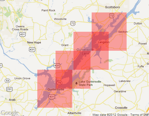
This image represents a lake coverage area selected in Northeast Alabama, and named 'Lake Guntersville'
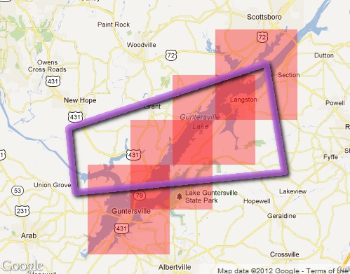
WxText allows you to register a specific location for your most common routes and/or lakes and assign them a name. You can register up to 3 lake locations or routes by clicking on boxes which are 10 miles on each side. When the National Weather Service (NWS) issues a warning which impacts one of your locations or routes, you will receive a text message like this which contains the TYPE of warning (tornado, severe thunderstorm, or flash flood) for the NAME of your pre-registered locations or routes, until the EXPIRATION TIME:
If you have a cell phone which is web-enabled, the text message contains a link to a GOOGLE MAP of the exact area and text of the warning.
NWS has issued a SEVERE THUNDERSTORM WARNING which will impact a portion of your designated Lake. Then you can see the exact warning area and if you are impacted.
When a warning is NO LONGER IN EFFECT, a second text message arrives:
Please click on Sign-Up button below to begin the registration process for ABAWxText, the only SMS text message service capable of delivering location-specific, official severe weather warnings.